From NASA's Planetary Photojournal
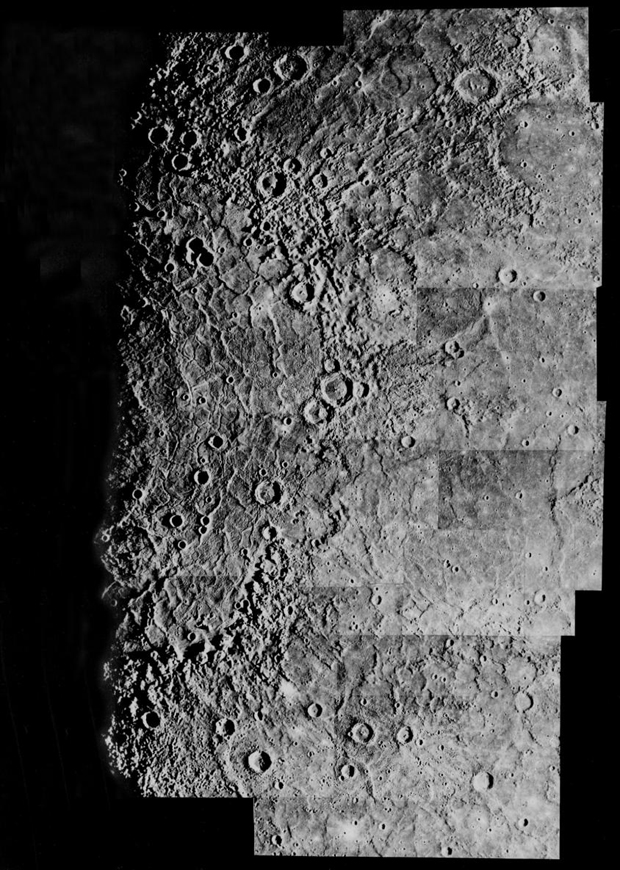
The largest basin on Mercury (1300 km or 800 miles across) was named Caloris (Greek for 'hot') because it is one of the two areas on the planet that face the Sun at perihelion. The Image Processing Lab at NASA's Jet Propulsion Laboratory produced this photomosaic using computer software and techniques developed for use in processing planetary data. The Mariner 10 spacecraft imaged the region during its initial flyby of the planet in 1974.
Image Title: Mercury: Computer Photomosaic of the Caloris Basin
Catalog #: PIA03102
Photo Target Name: Mercury
Reference: Davies, M. E., S. E. Dwornik, D. E. Gault, and R. G. Strom, Atlas of Mercury, NASA SP-423 (1978).
Spacecraft/Mission: Mariner 10
Last Modified On: Friday, March 3 2001