From Visible Earth
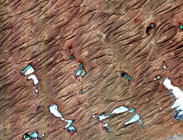
This ASTER sub-scene covers an area of 12 x 15 km in NW India in the Thar Desert. The sand dunes of the Thar Desert constantly shift and take on new shapes. Located in northwestern India and eastern Pakistan, the desert is bounded on the south by a salt marsh known as the Rann of Kutch, and on the west by the Indus River plain. About 800 kilometers long and about 490 kilometers wide, the desert's terrain is mainly rolling sandhills with scattered growths of shrub and rock outcroppings. Only about 12 to 25 centimeters of rain fall on the desert each year, and temperatures rise as high as 52 degrees Celsius. Much of the population is pastoral, raising sheep for their wool.
The Advanced Spaceborne Thermal Emission and Reflection Radiometer (ASTER) is one of five Earth-observing instruments launched December 18, 1999, on NASA's Terra satellite. The instrument was built by Japan's Ministry of International Trade and Industry. The primary goal of the ASTER mission is to obtain high-resolution image data in 14 channels over the entire land surface, as well as black and white stereo images. With revisit time of between 4 and 16 days, ASTER will provide the capability for repeat coverage of changing areas on Earth's surface.
Image Title: Thar Desert
Target Name: Earth
Spacecraft: ASTER
Credit: NASA/GSFC/MITI/ERSDAC/JAROS and U.S./Japan ASTER Science Team
Back to Earth photographs index.
Last Modified On: Friday, May 11, 2001