From NASA's Planetary Photojournal
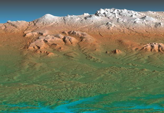
This perspective view shows the western side of the volcanically active Kamchatka Peninsula, Russia. The data are from a C-band mapping swath of the Shuttle Radar Topography Mission (SRTM). In the foreground is the broad, flat flood plain of the Amanina River, shown in blue. In background of the image is the Sredinnyy Khrebet, the volcanic mountain range that makes up the spine of the peninsula. The cluster of hills in the upper right is a field of small dormant volcanoes.
This shaded relief perspective view was generated using topographic data from the Shuttle Radar Topography Mission. A computer-generated artificial light source illuminates the elevation data to produce a pattern of light and shadows. Slopes facing the light appear bright, while those facing away are shaded. On flatter surfaces, the pattern of light and shadows can reveal subtle features in the terrain. Colors show the elevation as measured by SRTM. Colors range from blue at the lowest elevations to white at the highest elevations. This image contains about 2300 meters (7500 feet) of total relief. To emphasize subtle differences in topography, the relief is exaggerated by a factor of 5.
Image Title: Perspective View, Kamchatka Peninsula, Russia
Catalog #: PIA02707
Target Name: Earth
Spacecraft/Instument: Shuttle Radar Topography Mission
Back to Earth photographs index.
Last Modified On: Tuesday, December 19, 2000