From NASA's Planetary Photojournal
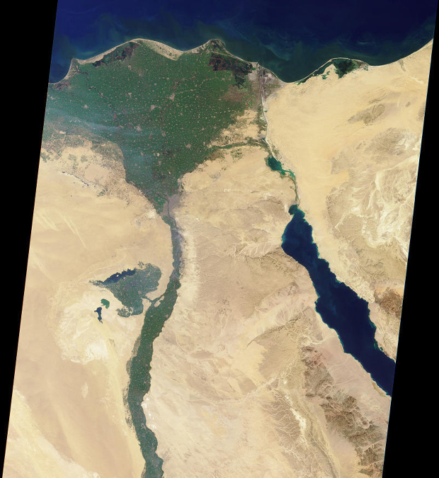
This image of the northern portion of the Nile River was captured by MISR's nadir camera on January 30, 2001 (Terra orbit 5956). The Nile is the longest river in the world, extending for about 6700 kilometers from its headwaters in the highlands of eastern Africa. At the apex of the fertile Nile River Delta is the Egyptian capital city of Cairo. To the west are the Great Pyramids of Giza. North of here the Nile branches into two distributaries, the Rosetta to the west and the Damietta to the east. Also visible in this image is the Suez Canal, a shipping waterway connecting Port Said on the Mediterranean Sea with the Gulf of Suez. The Gulf is an arm of the Red Sea, and is located on the right hand side of the picture.
Image Title: The Nile
Catalog #: PIA02647
Photo Target Name: Earth
Image Credit: NASA/GSFC/JPL, MISR Team
Spacecraft/Mission: Terra
Last Modified On: Wednesday, February 28, 2001