From NASA's Planetary Photojournal
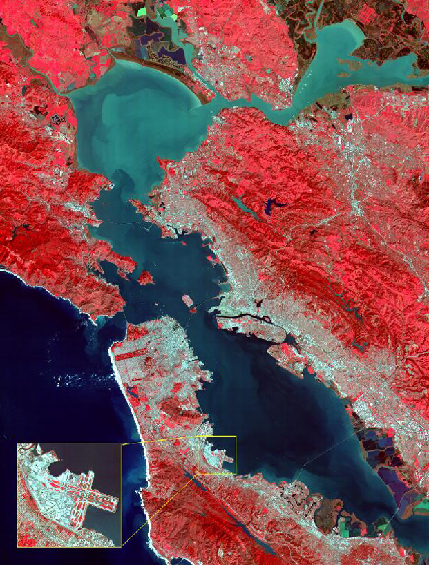
This image of the San Francisco Bay region was acquired on March 3, 2000 by the Advanced Spaceborne Thermal Emission and Reflection Radiometer (ASTER) on NASA's Terra satellite with its 14 spectral bands from the visible to the thermal infrared wavelength region, and its high spatial resolution of 15 to 90 meters (about 50 to 300 feet ). This image covers an area 60 kilometers (37 miles) wide and 75 kilometers (47 miles) long in three bands of the reflected visible and infrared wavelength region. The combination of bands portrays vegetation in red, and urban areas in gray. Sediment in the Suisun Bay, San Pablo Bay, San Francisco Bay, and the Pacific Ocean shows up as lighter shades of blue. Along the west coast of the San Francisco Peninsula, strong surf can be seen as a white fringe along the shoreline. A powerful rip tide is visible extending westward from Daly City into the Pacific Ocean. In the lower right corner, the wetlands of the South San Francisco Bay National Wildlife Refuge appear as large dark blue and brown polygons. The high spatial resolution of ASTER allows fine detail to be observed in the scene. The main bridges of the area (San Mateo, San Francisco-Oakland Bay, Golden Gate, Richmond-San Rafael, Benicia-Martinez, and Carquinez) are easily picked out, connecting the different communities in the Bay area. Shadows of the towers along the Bay Bridge can be seen over the adjacent bay water. With enlargement the entire road network can be easily mapped; individual buildings are visible, including the shadows of the high-rises in downtown San Francisco.
Inset: This enlargement of the San Francisco Airport highlights the high spatial resolution of ASTER. With further enlargement and careful examination, airplanes can be seen at the terminals.
Image Title: ASTER Images San Francisco Bay Area
Catalog #: PIA02606
Target Name: Earth
Spacecraft: ASTER
Back to Earth photographs index.
Last Modified On: Tuesday, December 19, 2000