From Visible Earth
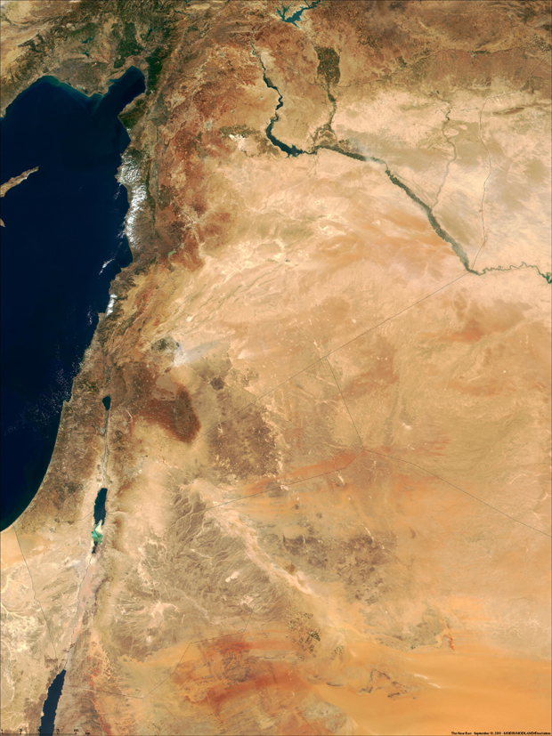
This true-color image was taken on September 10, 2000, by the MODerate-resolution Imaging Spectroradiometer (MODIS) flying aboard NASA's Terra spacecraft. The image shows the lands of Israel along the eastern shore of the Mediterranean Sea, with the countries of Jordan to the southeast and Syria to the Northeast. Jerusalem is Israel's capital city and Aman is the capital of Jordan. The region known as the "West Bank" lies between the two countries. Running from north to south, the Jordan River links the Sea of Galilee to the Dead Sea.
Image Title: MODIS Views the Middle-East
Target Name: Earth
Image courtesy of Jacques Descloitres, MODIS Land Group, NASA GSFC
Back to Earth photographs index.
Last Modified On: Sunday, December 17, 2000